
Soil Associations
0571d FYFIELD 1
Soil and site characteristics
Well drained coarse and fine loamy soils over interbedded sands and sandstones. Similar fine loamy soils with slowly permeable subsoils and slight seasonal waterlogging. Slight risk of water erosion.
Geology
Cretaceous loam
Cropping and Land Use
Cereals, potatoes, vegetables and fruit.
Component soil series
| Subgroup | Series name | Percentage | WRB 2006 link |
|---|---|---|---|
| 5.71 | FYFIELD | 60% | Chromic Luvisols |
| 5.71 | DUNDALE | 20% | Haplic Luvisols |
| 5.72 | BURSLEDON | 10% | Endostagnic Luvisols |
Covers 67 km2 in England and Wales
Soilscapes Classification
| 6 |
Freely draining slightly acid loamy soils |
0571d FYFIELD 1
Detailed Description
Some of the most useful agricultural land in Surrey, east Hampshire and West Sussex is loamy Fyfield and fine loamy Dundale series, well drained typical argillic brown earths, together cover most of the land. These soils pass to sand or sandstone at moderate depth, are easy to work and allow free rooting when well managed. They occur mainly in broad shallow valleys or on other gently sloping land at the foot of the Hythe Beds dipslope but are on steeper scarp slopes between Reigate and Oxted. The associated fine loamy Bursledon soils, stagnogleyic argillic brown earths with slowly permeable subsoils, are found locally on low hills or ridges formed in Sandgate Beds and in glauconitic Hythe Beds. The land is mostly below 100 m O.D. in Hampshire and Sussex, but rises to 200 m O.D. in Surrey.
Deep, well drained coarse loamy Maplestead and stoneless silty Hamble soils are developed in thick, partly aeolian drift in the bottom of dry valleys. Wet, coarse loamy Swanwick and fine loamy Shabbington soils occur near rivers and streams. Sandy and ferruginous soils belonging to Frilford and Fernhill series are included locally on the highest land. Occasionally waterlogged, coarse loamy soils passing downwards to weathered glauconitic sandstone are found in orchards near Nutbourne.
Soil Water Regime
There is much variation in water regime even among soils with the same gley morphology. Most soils show some evidence, in the form of grey and ochreous mottling, of periodic or prolonged waterlogging by groundwater. Field observations suggest that mottled soils with humose topsoils may be waterlogged for part of the growing season (Wetness Class IV or V) whilst non-humose alluvial gley soils are wet mainly in winter (Wetness Class III to IV). Where pump or arterial drainage schemes operate, waterlogging is reduced in winter (Wetness Class III). A modern border-dyke irrigation system has been installed at one site in Wiltshire on an experimental basis.
Cropping and Land Use
There are long periods in autumn and spring when Fyfield and Dundale soils can be cultivated safely, though there are fewer days in West Sussex than elsewhere. Timing of cultivations is strongly influenced by the local distribution of Bursledon soils which take longer to drain after heavy rain than Fyfield and Dundale soils. With care, yields of direct drilled winter sown cereal crops are similar to those obtained with traditional cultivations. Heavy rain when the soils are already saturated causes sheet, rill and, in extreme cases, gully erosion on Fyfield soils. Erosion occurs particularly where there is a sandstone or closely-packed sand substrate. The risk is greatest where there is little topsoil organic matter, the soils are compacted by traffic and crop cover is sparse. Water erosion often occurs on slopes of only 3-7° but the risk is reduced if cultivations are carried out across the slope.
Most of the land is used for arable farming with some grass leys. Cereal crops, which are widely grown, rarely suffer from drought. The main soils are suitable for potatoes and field vegetables, though irrigation is necessary in most years for consistently large yields. Permanent grassland and long leys are rare and are chiefly found on farms keeping horses. Top and soft fruit are grown in West Sussex on predominantly south-facing slopes as around Nutbourne. Fyfield and Dundale soils are inherently acid, but with regular liming crop failures from acidity are rare. Waller (1973) studying these soils in Kent, where they were formerly mapped as Barming series, reported that phosphorus status is better than average, but that potassium and magnesium deficiencies occurred in potatoes, brassicas and top fruit. He also discusses trace elements and other aspects of soil fertility.
0571d FYFIELD 1
Distribution Map
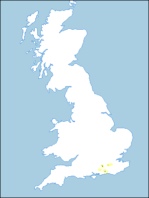 |
Note that the yellow shading represents a buffer to highlight the location of very small areas of the association.
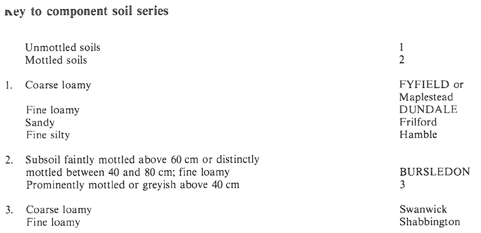
Keys to component soil series
South Eastern Region
 |
All information Copyright, Cranfield University © 2025
Citation: To use information from this web resource in your work, please cite this as follows:
Cranfield University 2025. The Soils Guide. Available: www.landis.org.uk. Cranfield University, UK. Last accessed 25/04/2025
