
Soil Associations
0571s EFFORD 1
Soil and site characteristics
Well drained fine loamy soils often over gravel associated with similar permeable soils variably affected by groundwater.
Geology
Marine and river terrace gravel
Cropping and Land Use
Cereal and grassland rotations; some horticultural and glasshouse crops; deciduous woodland in Hampshire.
Component soil series
| Subgroup | Series name | Percentage | WRB 2006 link |
|---|---|---|---|
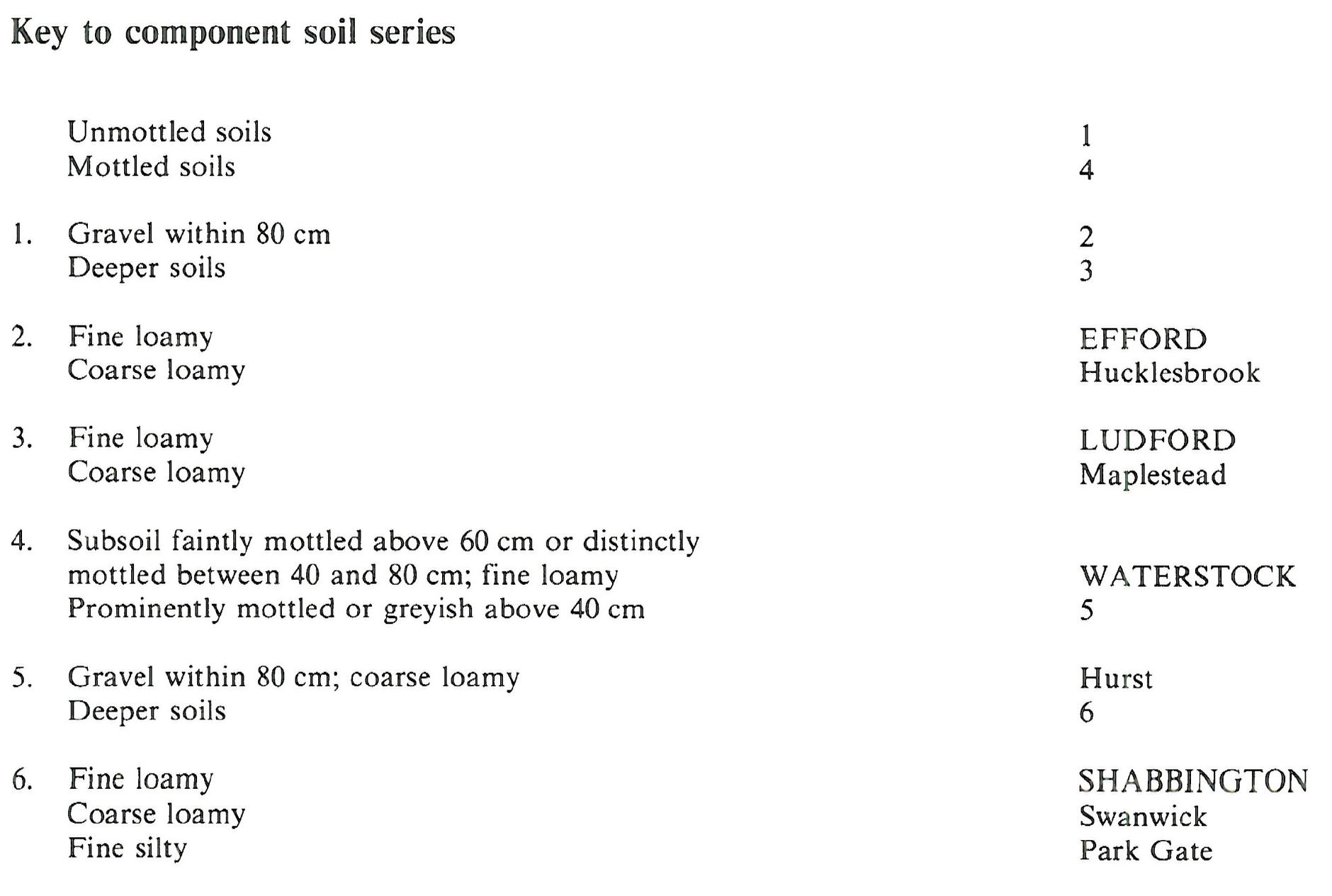
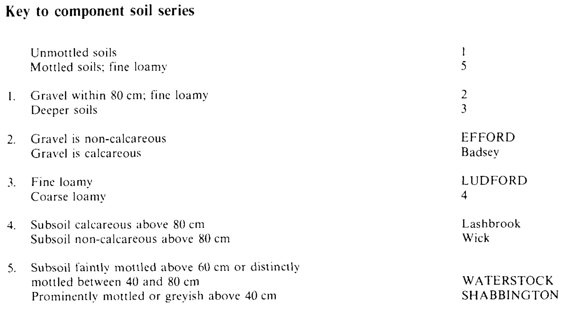
| 5.71 | EFFORD | 41% | Endoskeletic Luvisols |
| 5.71 | LUDFORD | 39% | Haplic Luvisols |
| 5.73 | WATERSTOCK | 15% | Endogleyic Luvisols |
| 8.41 | SHABBINGTON | 5% | Luvic Gleysols |
Covers 309 km2 in England and Wales
Soilscapes Classification
| 6 |
Freely draining slightly acid loamy soils |
0571s EFFORD 1
Detailed Description
This association consists mainly of well drained brown fine loamy soils on level or gently sloping river terraces where drift overlies gravel. Efford soils are slightly or moderately stony, fine loamy typical argillic brown earths with gravelly subsoils. The associated Ludford soils are similar argillic brown earths but occur where thicker loamy drift covers the gravel. Fine loamy Waterstock soils, gleyic argillic brown earths, and Shabbington soils, typical argillic gley soils, are common on low ground especially at the margins of river terraces and in narrow valleys. The association occurs mainly in Hampshire, Bedfordshire and Cambridgeshire, but there are small areas in Essex, West Sussex, Dorset and the Isle of Wight.
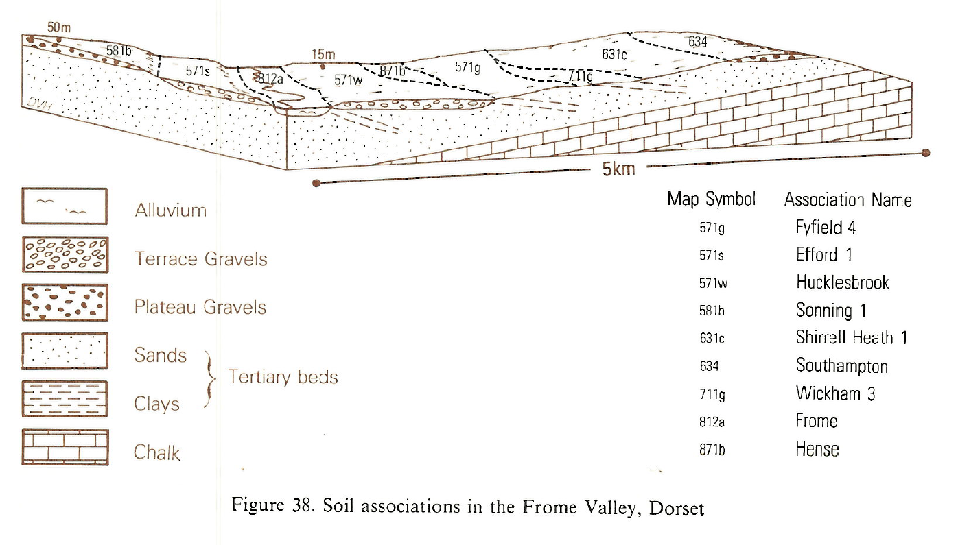
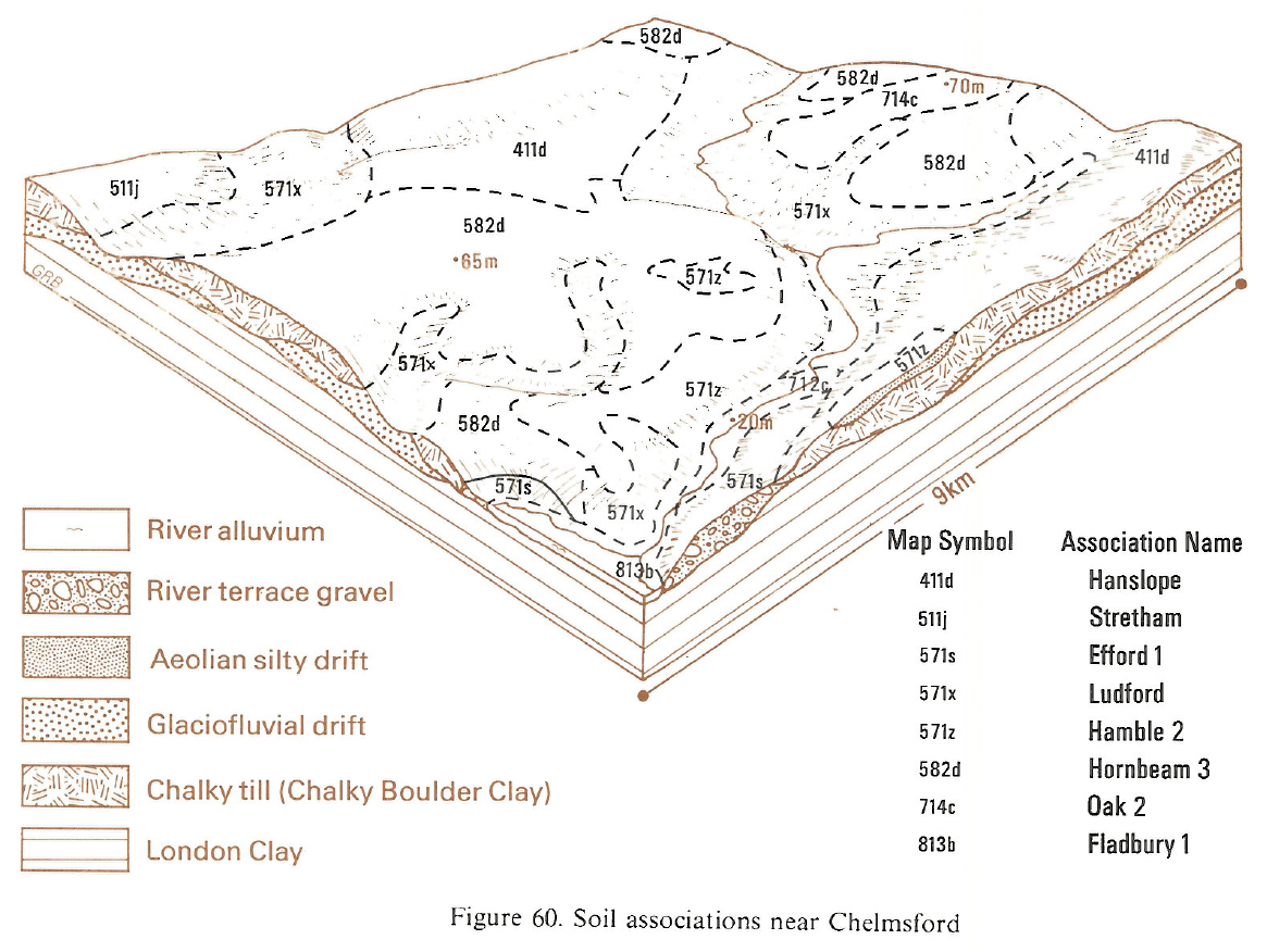
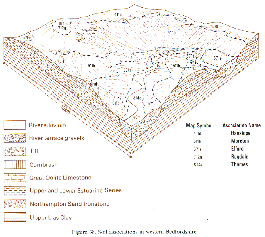
In Bedfordshire and Cambridgeshire, the association occurs on river terraces flanking the river Ouse, and near Great Staughton, where river terrace drift caps low ridges within the clay vale. As well as Efford and Ludford series, Sutton and Wick soils are common. Calcareous Badsey, on chalk gravel, and Lashbrook soils occur locally, and where the underlying Jurassic clay is near the surface, gleyic Waterstock and Worminghall soils are present. Shabbington soils are uncommon. Along the Chelmer, near Chelmsford the subsidiary soils include the well drained reddish fine loamy Terling series. In Dorset, the association occurs on flat or gently sloping low terraces along the Frome, downstream of Dorchester.
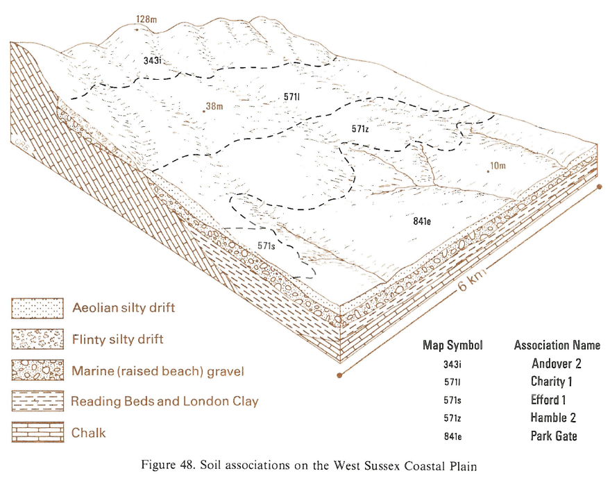
The association is found mainly on the lower parts of the south Hampshire coastal plain, where thin loamy drift covers gravel, possibly of marine origin. The soils are predominantly fine loamy, but some coarse loamy well drained soils of the Hucklesbrook and Maplestead series occur between Exbury, Lepe and Fawley. On lower slopes and valley bottoms there are inclusions of Swanwick, Hurst and Park Gate soils. The soils are developed over marine gravel in West Sussex where they were formerly mapped as Lyminster and Calcetto series. In the Arun valley south of Pulborough, Hucklesbrook, Maplestead and Hurst soils are also present on the river terraces. On the Isle of Wight, the association is mapped on thicker relatively stoneless drift over gravel, and Ludford and Maplestead soils predominate. The usual wetter associate soils are absent. In north Hampshire around Eversley, an area dominated by coarse loamy Hucklesbrook and Swanwick soils has been mapped with the association.
Soil Water Regime
Soils of this association have a wide range of water regimes, but the main Efford and Ludford soils are permeable, well drained and rarely wet (Wetness Class I). Winter rain is quickly absorbed and there is little surface run-off, except on arable land with poor soil structure. In the Ouse valley widespread abstraction of groundwater for irrigation has lowered the regional water-table so that gleyed soils are not usually wetter than ungleyed soils. However, elsewhere Waterstock and Shabbington soils on valley sides and floors are affected by groundwater held up by underlying impermeable clays and are occasionally or seasonally waterlogged (Wetness Class II or III). These soils benefit from drainage measures, but often their small extent and distribution pattern make improvement impractical. Because Efford soils have very stony subsoil layers, they are moderately droughty for cereals; the deeper Ludford soils are less droughty. All the soils are moderately droughty for potatoes and very droughty for grass, and in dry years all crops may suffer severely.
Cropping and Land Use
Most soils on the river terraces are easy to work and there are long periods in autumn and spring for farm operations. The large fine sand and silt content of most topsoils causes unstable structure particularly in arable fields where organic matter levels are low. Slaking and pan formation are exacerbated by careless timing of farm operations. Arable farming is predominant west and north of Bedford, but market gardening is the main land use along the Ouse valley between Bedford and St Neots. The distribution of market gardening probably reflects historical rather than climatic or soil factors.
In the South East grassland productivity is severely restricted by droughtiness, and cereal ley rotations are the usual practice. Grass yields are enhanced in south Hampshire and West Sussex, however, by an autumn flush of growth. Soft fruit and potatoes are also grown, and respond to irrigation. In south Hampshire, some land remains as woodland and provides cover for game birds. Glasshouse crops are grown north of Lymington.
0571s EFFORD 1
Distribution Map
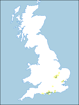 |
Note that the yellow shading represents a buffer to highlight the location of very small areas of the association.
Keys to component soil series
South Eastern Region
 |
Eastern Region
 |
Typical Landscapes
South Western Region
 |
Eastern Region
 |
Eastern Region
 |
South Eastern Region
 |
All information Copyright, Cranfield University © 2025
Citation: To use information from this web resource in your work, please cite this as follows:
Cranfield University 2025. The Soils Guide. Available: www.landis.org.uk. Cranfield University, UK. Last accessed 25/04/2025
