Soil Associations
0571A Rowton
Soil and site characteristics
Well drained fine silty and fine loamy soils locally over gravel. Some fine silty over clayey soils with slowly permeable subsoils and seasonal waterlogging and some slowly permeable seasonally waterlogged fine silty over clayey soils.
Geology
Glaciofluvial or river terrace gravel and till
Cropping and Land Use
Cereals and short term grassland; some potatoes and fruit.
Component soil series
| Subgroup | Series name | Percentage | WRB 2006 link |
|---|---|---|---|
| 5.71 | ROWTON | 30% | Endoskeletic Luvisols |
| 5.72 | HAMPERLEY | 25% | Siltic Endostagnic Luvisols |
| 7.11 | PROLLEYMOOR | 10% | Eutric Luvic Stagnosols |
| 5.41 | RHEIDOL | 10% | Eutric Endoskeleti-Eutric Cambisols |
Covers 130 km2 in England and Wales
Soilscapes Classification
| 6 |
Freely draining slightly acid loamy soils |
0571A Rowton
Detailed Description
The association of yellowish brown silty soils, is extensive on gently undulating glaciofluvial terraces and till in the Welsh Borderland notably in south Shropshire, north Herefordshire and east Powys. The terrace deposits and till are of similar composition and difficult to distinguish from each other (Hodgson 1972, Mackney and Burnham 1966). The included stones are mainly local in origin, generally siltstones, fine grained sandstones and shales with occasional Welsh greywackes and igneous stones. On the terraces, the soils usually overlie gravel at less than 1 metre depth and are either silty typical argillic brown earths, Rowton series, or less commonly fine loamy typical brown earths, Rheidol series. The soils on till have slowly permeable subsoils, and are represented by fine silty stagnogleyic argillic brown earths, Hamperley series, and the fine silty over clayey typical stagnogleys, Prolleymoor series. There are small inclusions of East Keswick, Sannan, Pinsley (Hodgson 1972) and Ludford series (Heaven 1978). Rowton series dominates especially on gently undulating gravel terrace deposits along the Clun, Teme, Lugg and Onny. These deposits contain patches of till and merge away from the rivers into mounded till country with occasional lenses of glaciofluvial outwash gravels. Hamperley and Prolleymoor series are extensive on the compact tills with Prolleymoor soils generally restricted to hollows. Around the Long Mynd the association is developed in dusky red Head containing substantial amounts of Precambrian (Longmyndian) rocks. Subsoils here are more clayey and slowly permeable and because of the high rainfall the proportion of Prolleymoor soils is larger. Narrow tracts of alluvium, adjacent to the streams have been included in the association and Rowton soils often gradually merge into alluvial soils becoming deeper and less stony.
Soil Water Regime
Rowton and Rheidol series are well drained (Wetness Class I) as they overlie very permeable gravels. The Hamperley soils are seasonally waterlogged (Wetness Class III) but on steep slopes particularly under permanent grass where run-off is substantial or where they are artificially drained they have a drier regime. The water regime of Prolleymoor soils varies with rainfall, soil porosity and slope. Most are seasonally waterlogged (Wetness Class IV) but around the Long Mynd they are severely waterlogged (Wetness Class V). After artificial drainage the more porous of the Prolleymoor soils are probably Wetness Class III.
Cropping and Land Use
This association provides good farming land. Permanent grassland is extensive on Prolleymoor and to a lesser extent Hamperley soils, whereas the level ground typical of the Rowton and Rheidol series is often used for cereals and occasionally roots and fruit. Rowton soils are easy to cultivate but their large silt contents make them susceptible to capping on recently ploughed or sparsely vegetated fields. The number of suitable days for spring cultivation is severely limited. Hamperley and Prolleymoor soils are moderately difficult to cultivate and, because of slow subsoil permeability good soil conditions for cultivation occur only during the autumn in most years. Therefore to avoid unnecessary structural damage during spring cultivation autumn seed-bed preparation is necessary. Capping is again a problem with the added risk of subsequent erosion on sloping land. The soils have adequate moisture reserves for crops but are slightly droughty for grass. Sugar beet and potatoes are occasionally grown on Rowton soils and although stones are usually common in surface horizons they are generally too small to interfere with cultivations. Grass swards on Hamperley and Prolleymoor soils poach and compact readily and therefore deteriorate as weed species colonize the bare patches. There is little poaching risk on Rowton soils.
0571A Rowton
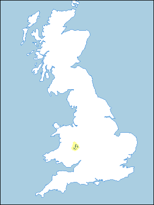
Distribution Map
 |
Note that the yellow shading represents a buffer to highlight the location of very small areas of the association.
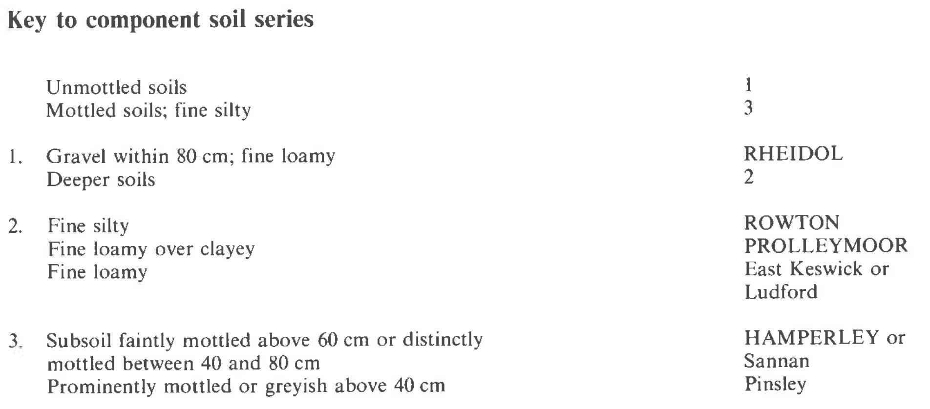
Keys to component soil series
Midlands
 |
All information Copyright, Cranfield University © 2025
Citation: To use information from this web resource in your work, please cite this as follows:
Cranfield University 2025. The Soils Guide. Available: www.landis.org.uk. Cranfield University, UK. Last accessed 25/04/2025
