
Soil Associations
0581d CARSTENS
Soil and site characteristics
Well drained fine silty over clayey, clayey and fine silty soils, often very flinty.
Geology
Plateau drift and clay-with-flints
Cropping and Land Use
Winter cereals, often in rotation with grass; stock rearing; some deciduous and coniferous woodland.
Component soil series
| Subgroup | Series name | Percentage | WRB 2006 link |
|---|---|---|---|
| 5.81 | CARSTENS | 60% | Profundic Chromic Luvisols |
| 5.71 | CHARITY | 10% | Chromic Luvisols |
| 5.81 | GIVENDALE | 10% | Clayic Profundic Chromic Luvisols |
| 5.81 | WINCHESTER | 10% | Clayic Chromic Endoleptic Luvisols |
Covers 1066 km2 in England and Wales
Soilscapes Classification
| 6 |
Freely draining slightly acid loamy soils |
0581d CARSTENS
Detailed Description
This association is extensive in southern England where the Chalk is covered by silty aeolian drift over Clay-with-flints and Plateau Drift, and in Lincolnshire where it occurs on chalky till. The principal soils are deep and well drained, usually with reddish clayey subsoils. Carstens soils are fine silty over clayey typical paleo-argillic brown earths that constitute more than half of the association. Of smaller extent are similar but clayey soils of the Winchester and Givendale series, the former occurring where chalk is within moderate depth. The reddish brown subsoils indicate weathering during warm interglacial or interstadial periods (Avery 1980). Fine silty typical argillic brown earths in deep drift, the Charity series, occur locally.
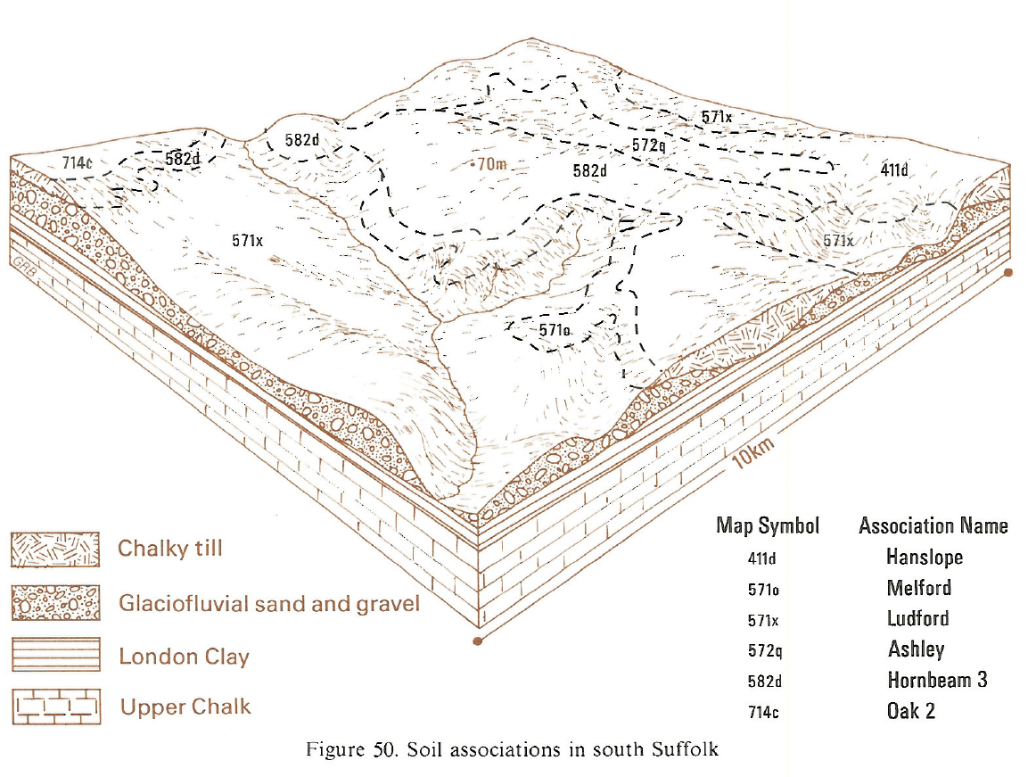
On the Chiltern dipslope south-west of St Albans, Carstens soils predominate on flat ground with Winchester soils on spurs and valley sides and Charity soils in valley bottoms. In Lincolnshire, on the higher Wolds north-west of Louth, the association is mapped where aeolian silty drift overlies a flinty reddish clay formed by weathering from the very chalky Calcethorpe Till which usually occurs within 1 m depth. Carstens soils predominate, with Charity soils where the silty drift is thickest, and Givendale soils where it is thin or absent. Winchester soils occur locally and there are also small inclusions of Kelstern series, on chalky till. Further south between Scamblesby and Spilsby, the upper silty drift is replaced by more sandy material so Marlow and Ludford series become more common, and there are fewer Carstens and Charity soils.
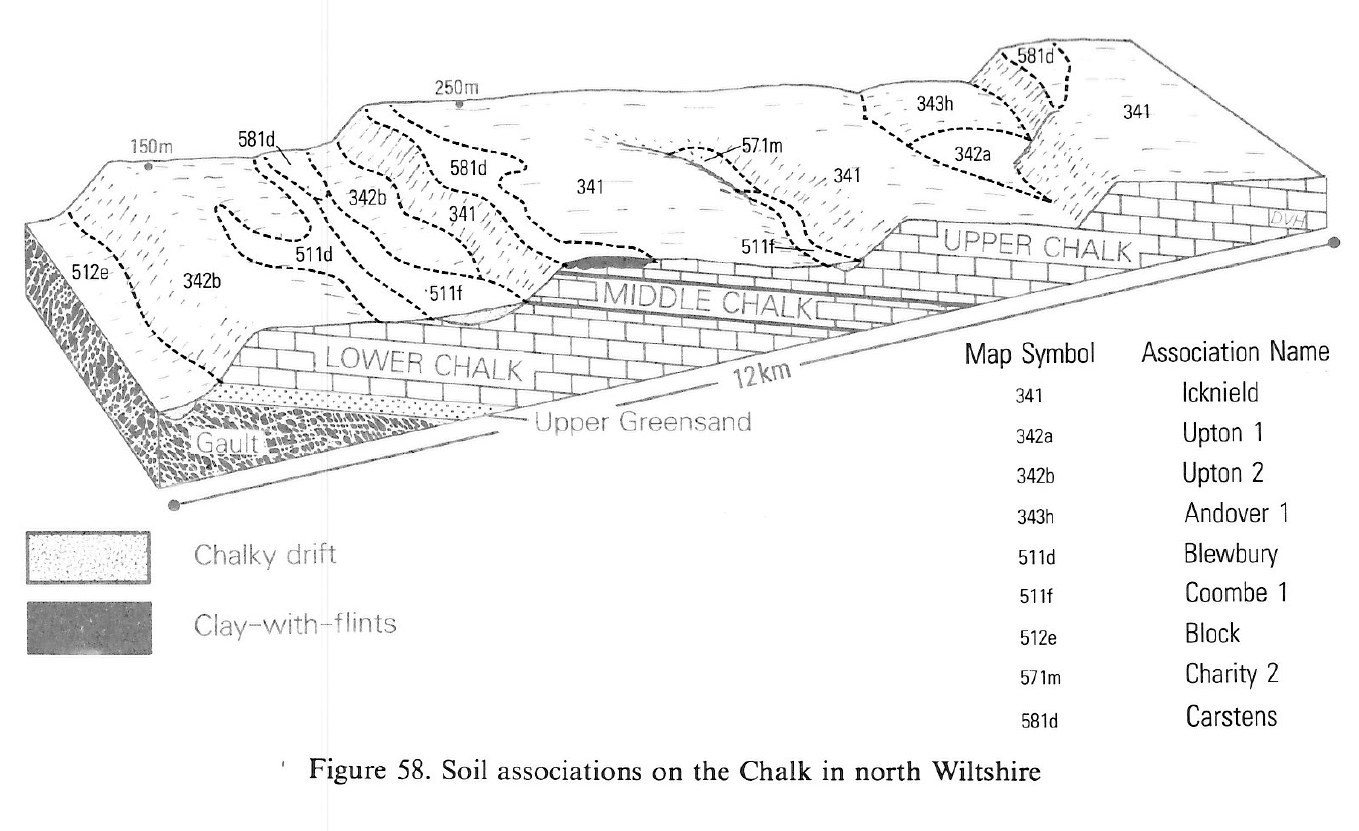
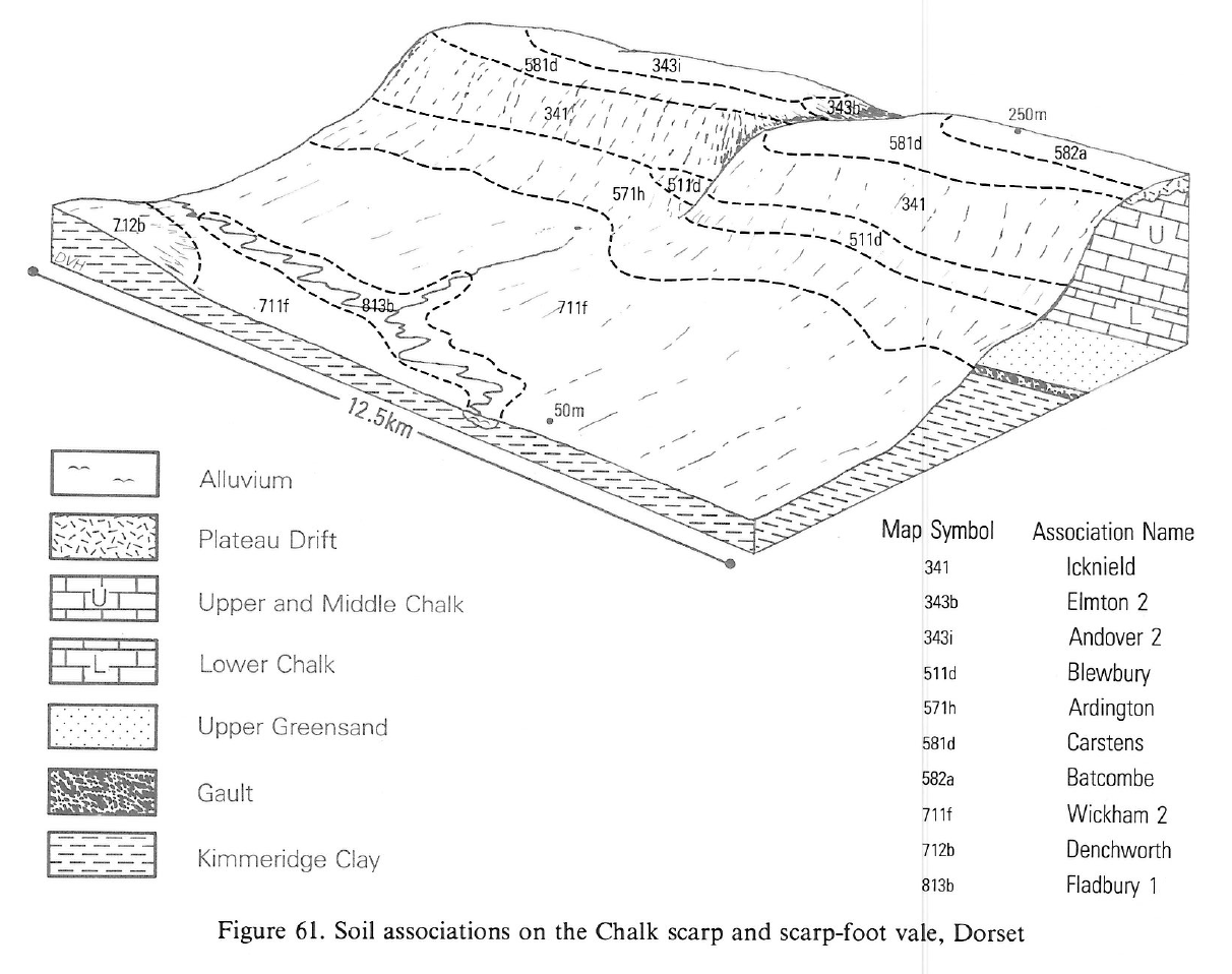
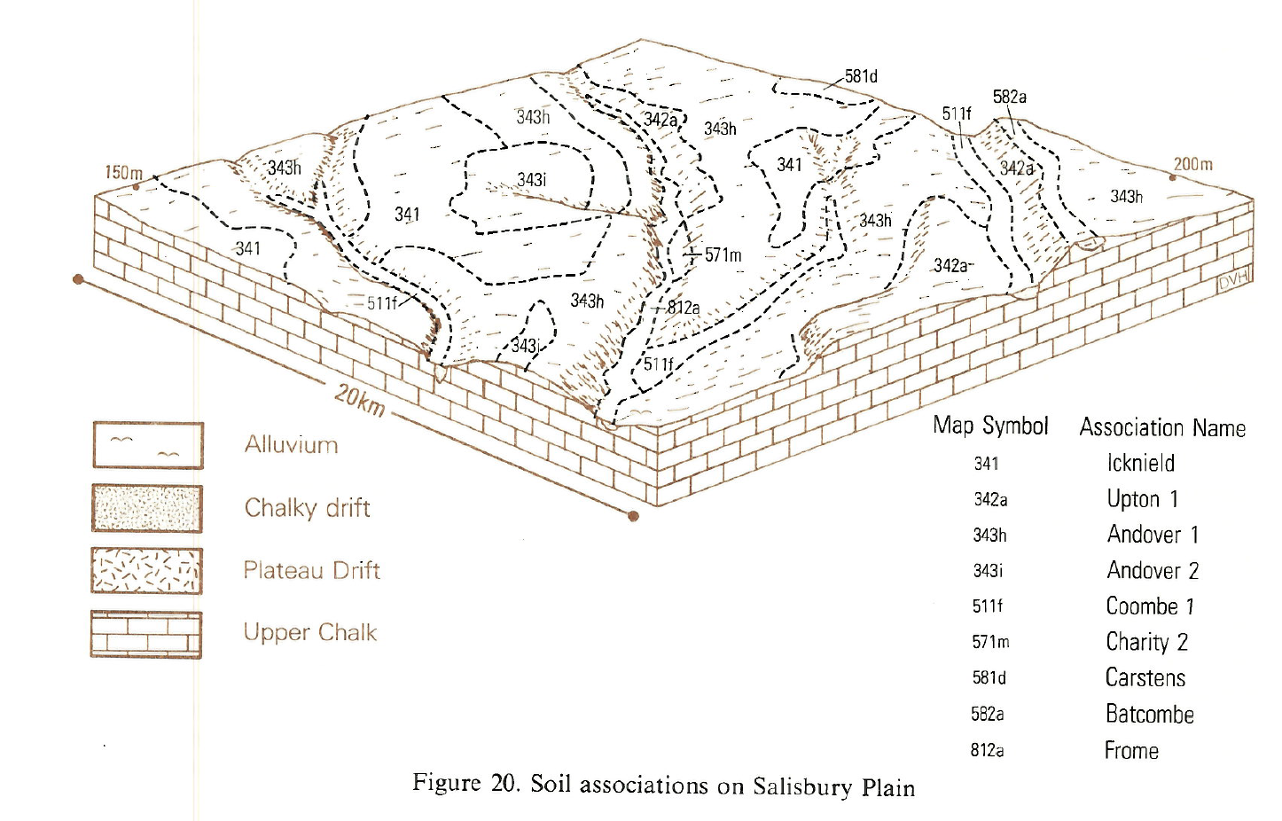
It is widespread on the dipslopes of Dorset and the higher parts of Salisbury Plain. In Wiltshire and Dorset, the association occurs on gently sloping ground between 120 and 270 m O.D. where the chalk was once covered by Tertiary deposits. Carstens series is dominant except in parts of Dorset and south Wiltshire where Porton, Garston and patches of shallow Wallop soils are common. Locally in and around Cranborne Chase, the characteristic silty drift covering the Clay-with-flints is sufficiently thick to give Charity soils. Clayey Winchester and Givendale soils occur on the ends of spurs and on small hills where the silty drift is absent. Andover and Wallop soils occur where the drift thins on the margins. In west Dorset, small patches of loamy Tertiary material give fine loamy over clayey Marlow soils, and north of Salisbury the same soils are found in Plateau Gravel. Bursledon and Frilford soils occupy loamy and sandy Tertiary remnants, and on the Dorset Downs Batcombe soils, with mottled clayey subsoils, occur in Plateau Drift. A small area of Carstens and Marlow soils has been identified south of Kingsbridge, Devon.
In Northern England the association is confined to very small areas near Wold Newton, south Humberside. The parent material is aeolian silty drift of variable depth over a flinty reddish clay which has resulted from weathering of the chalky till. The chalky substrate usually occurs within 1 m depth.
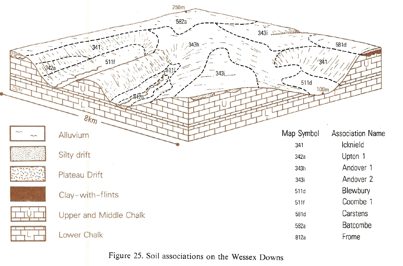
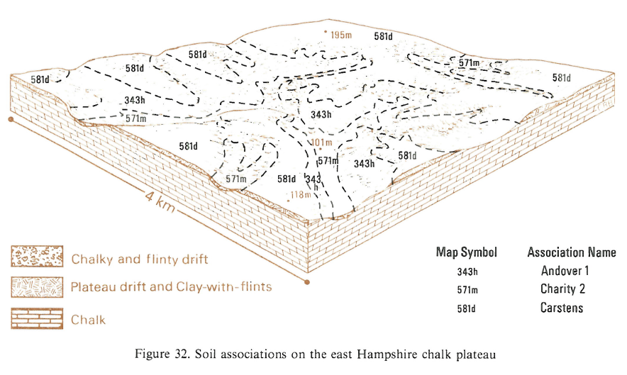
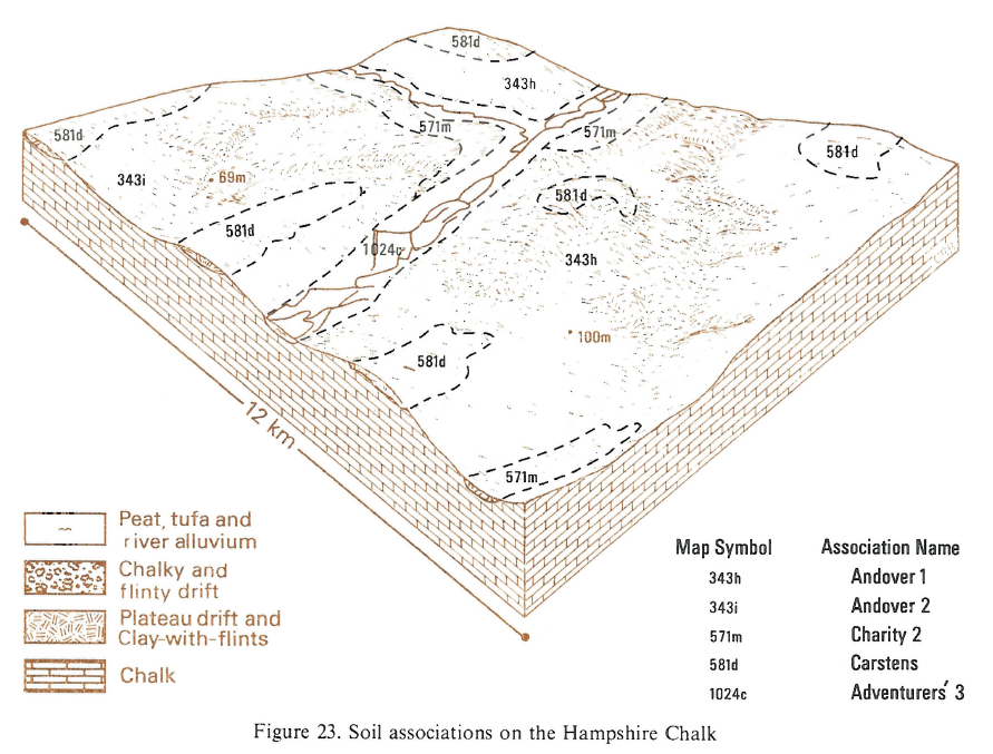
The association is most extensive on level surfaces in north and east Hampshire, particularly in a broad belt from Petersfield to Basingstoke and westwards to Andover, where the landscape becomes increasingly dissected. Carstens soils occur on the broader interfluves where the silty cover to the Clay-with-flints is consistently present. There are also small inclusions of Batcombe soils. Charity and the similar Garston soils occur in minor dry valleys. Between Andover and Winchester, where the landscape is most dissected, the association is restricted to narrow interfluves and hilltops, giving characteristic clay capped hills with shallow chalk soils of the Andover 1 association between. In such places the upper silty layer is thin or absent and soils are often developed directly in Clay-with-flints giving clayey Givendale and Winchester soils. Clayey Wallop soils are confined to the feather edge of the Clay-with-flints or to minor knolls, where chalk is at shallow depth. On the South Downs, the association is found to the north and north-west of Havant, and around Arundel. Where is occurs on the North Downs near Biggin Hill, there are inclusions of Batcombe and Marlow soils.
Soil Water Regime
Carstens, Givendale, Charity and Winchester soils have well structured clayey subsoil horizons which allow good drainage to the underlying chalk, so they are rarely waterlogged (Wetness Class I). Surface run-off is negligible and the presence of permeable soils on valley sides ensures good acceptance of winter rain.
Cropping and Land Use
Carstens and Charity soils are well suited to cultivation and are only slightly droughty for most arable crops. The weakly structured topsoils tend to slake and cap and then become cloddy on drying out in spring, so seed beds are difficult to prepare. There are good opportunities for autumn landwork but there are fewer days available for cultivations in spring especially in wet years. The soils are suited to direct drilling of winter cereals and, with good management, yields are similar to those achieved using conventional cultivations. Direct drilling of spring barley is less successful. In some districts, abundant broken flints in the topsoil causes severe implement and tyre wear and restrict cropping potential to cereals and grass, but where there are few flints root crops can be grown. The large retained water capacity of Givendale and Winchester topsoils make them sticky and plastic after wet weather and timeliness of cultivations is particularly important. All the soils are moderately droughty for grass and, given reasonable care, Carstens and Charity soils have little poaching risk and carry traffic well, though Givendale and Winchester soils are more vulnerable to poaching and stock cannot be outwintered. The soils are naturally acid, but because of repeated dressings of chalk many are neutral. Barley crops commonly suffer from acidity especially in areas recently cleared from woodland. Fertility is generally better than in the surrounding shallow chalk soils with larger amounts of phosphorus and potassium, but low levels of magnesium can lead to deficiencies in crops and livestock. Exposure on higher land can delay growth in spring. Winter wheat and winter barley are the main crops either grown continuously or with oilseed rape as a break. Other crops include sugar beet and potatoes with some vining peas.
The soils are well suited to the growth of trees and there are few limitations to establishment, maintenance and harvesting. Scots pine, the larches and Douglas fir are susceptible to lime-induced chlorosis and should not be planted where chalk occurs within 80 cm depth. Beech has been widely planted in managed woodlands, both alone and in mixed stands with Norway spruce, Western red cedar and various pines. The yield of beech in mixed stands is lower than the regional mean (Nicholls 1981). Douglas fir, oak, Japanese larch and Norway spruce give moderate yields but both Scots pine and Corsican pine yield better than the regional average. Other trees grown include Western red cedar, European larch and Western hemlock. Deciduous woodland, some of it very old, is common and includes parts of Cranborne Chase and the Royal Forest of Savernake. In Cranborne there is much hazel coppice with pedunculate oak, ash and maple standards as well as high forest of oak with some beech. The ground flora includes dog's mercury, sanicle and sweet woodruff (Galium odoratum). Savernake Forest is now commercially managed but incorporates old parkland with open pedunclate oak wood in which there are many large trees rich in epiphytic lichens.
On the North and South Downs the field capacity period is shorter than in Hampshire and the number of machinery work days in autumn and spring significantly greater. The soils are suited to direct drilling of winter cereals and, with good management, yields are similar to those achieved with conventional cultivations; direct drilling of spring barley is less successful, however. In some districts, abundant broken flints in the topsoil cause severe implement and tyre wear and restrict cropping potential to cereals and grass, but where there are few flints, root crops can be grown. In wetter districts there are few opportunities for spring landwork. The grass crop benefits from a flush of growth in the autumn in south Hampshire and West Sussex.
0581d CARSTENS
Distribution Map
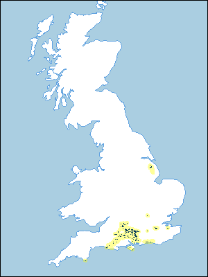 |
Note that the yellow shading represents a buffer to highlight the location of very small areas of the association.
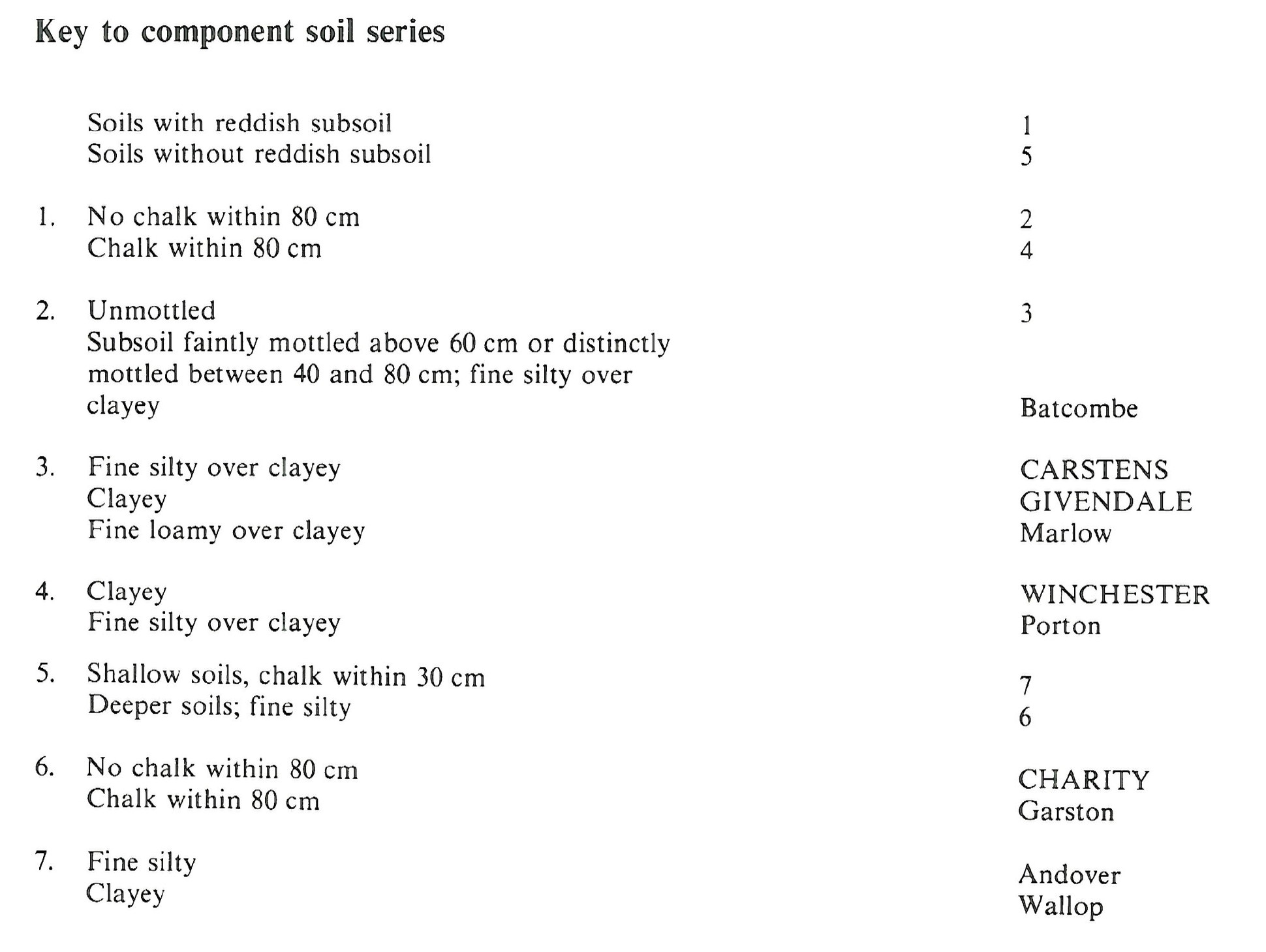
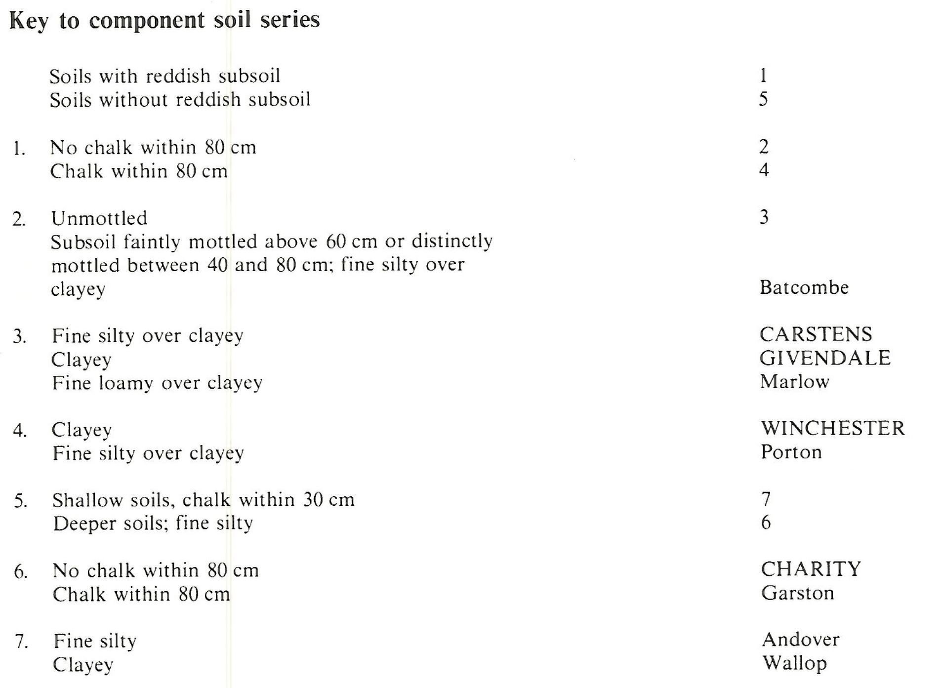
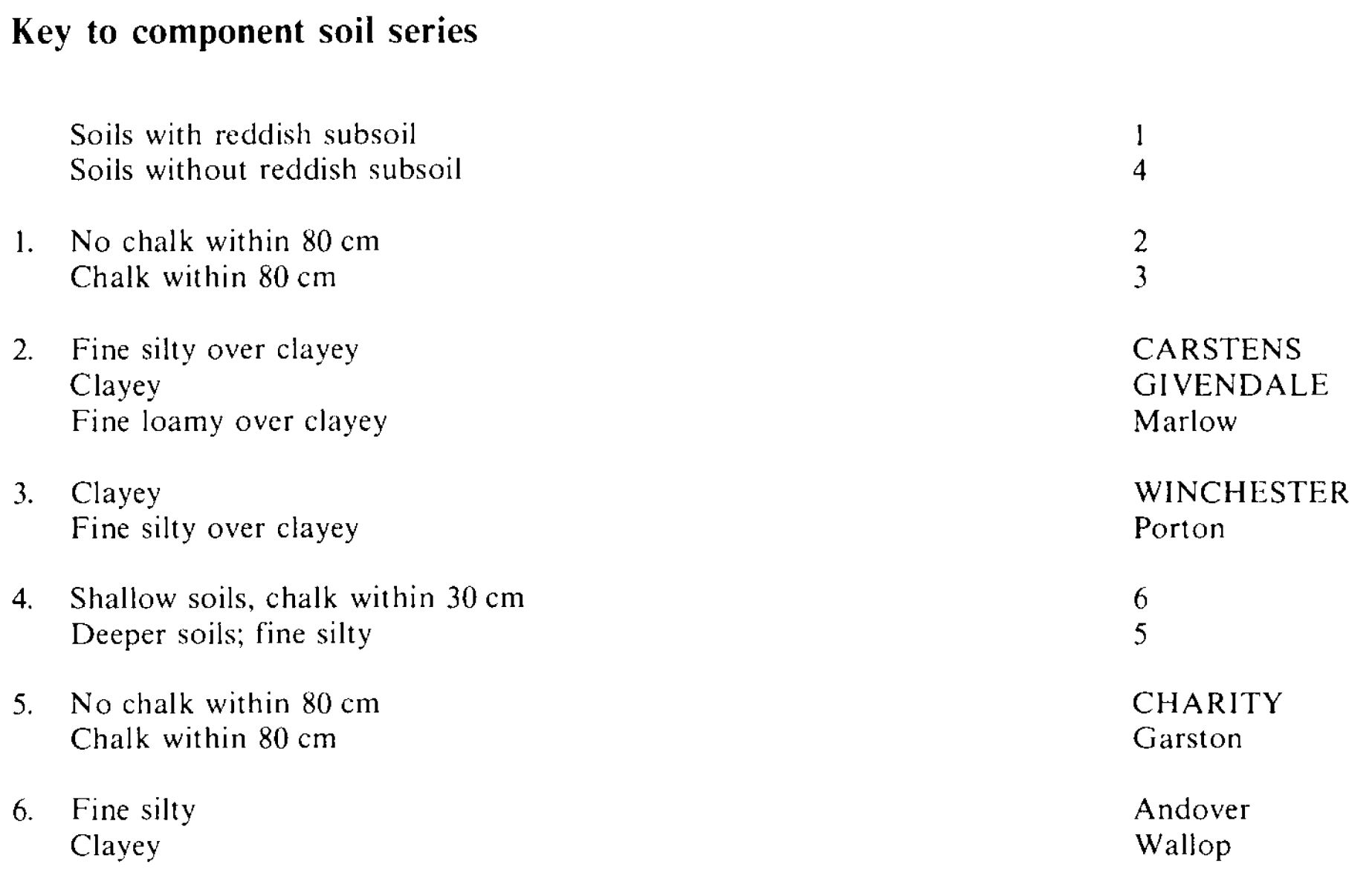
Keys to component soil series
South Eastern Region
 |
South Western Region
 |
Eastern Region
 |
Typical Landscapes
South Western Region
 |
South Western Region
 |
South Western Region
 |
South Western Region
 |
Eastern Region
 |
South Eastern Region
 |
South Eastern Region
 |
All information Copyright, Cranfield University © 2025
Citation: To use information from this web resource in your work, please cite this as follows:
Cranfield University 2025. The Soils Guide. Available: www.landis.org.uk. Cranfield University, UK. Last accessed 25/04/2025
