Soil Associations
0841e PARK GATE
Soil and site characteristics
Deep stoneless silty soils variably affected by groundwater.
Geology
Aeolian silty drift
Cropping and Land Use
Cereals, potatoes and field vegetables; glasshouse crops in West Sussex.
Component soil series
| Subgroup | Series name | Percentage | WRB 2006 link |
|---|---|---|---|
| 8.41 | PARK GATE | 70% | Siltic Luvic Gleysols |
| 5.73 | HOOK | 20% | Siltic Endogleyic Luvisols |
Covers 305 km2 in England and Wales
Soilscapes Classification
| 22 |
Loamy soils with naturally high groundwater |
0841e PARK GATE
Detailed Description
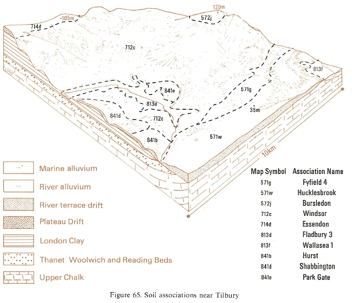
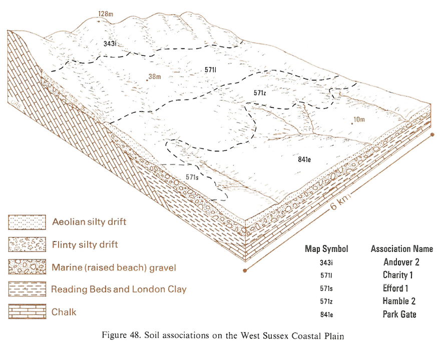
This association consists of deep stoneless silty Park Gate and Hook soils, typical argillic gleys and gleyic argillic brown earths respectively. Park Gate soils are affected by seasonally high groundwater, and have grey and ochreous mottled subsoil colours. Hook soils, which are only occasionally waterlogged and less mottled, usually occur slightly higher in the landscape. The soils are developed in silty aeolian drift, mainly over river and marine gravels. They occur on flat and gently sloping low-lying land in parts of some larger river valleys in southern England and on the West Sussex Coastal Plain. In Essex, the association occurs around Bulphan, on level land a little above the alluvium of the Mar Dyke. Ratsborough soils, fine silty over clayey stagnogleyic argillic brown earths, are also present; like Hook soils, Ratsborough soils are occasionally waterlogged.
Detailed mapping on the West Sussex Coastal Plain shows that many areas consist almost wholly of Park Gate soils. Hook and Hamble are the main subsidiary soils, and Shabbington series occurs sporadically. A similar extremely flinty fine silty seasonally waterlogged soil, formerly described as Binsted series, is present near the foot of the South Downs dipslope. In Hampshire, the association occurs on the westward extension of the coastal plain at Stubbington where silty drift covers river gravels or London Clay. Small inclusions of Wickham series are ubiquitous.
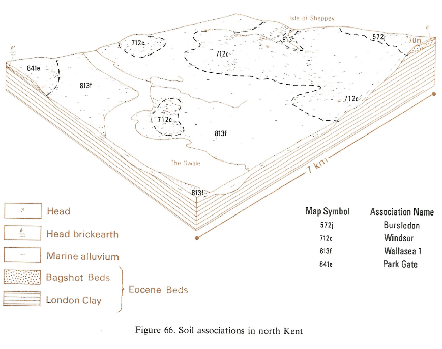
In Kent, the association occurs as narrow strips along valley bottoms and as wider spreads on the lower slopes of the valleys of the Medway north of Paddock Wood and of the East Stour. Here, Park Gate, Hook and Hamble soils occur, with some Wickham soils in places. In the Thames valley east of Slough, Park Gate and Hook soils are found where silty drift overlies London Clay. Along the Colne valley around Denham, Park Gate series is dominant but Hook and Hamble soils are also present, the latter on higher ground. Similar shallow soils occur where the silty drift is thin over flinty river terrace gravels. In Gunnersbury Park, Hamble series is generally found upslope of Hook and Park Gate soils and in Osterley Park, Park Gate and Hook series are present in equal proportions but around Southall, Park Gate is more common than Hook series.
Soil Water Regime
The soils are moderately permeable and affected by high winter water-tables. Park Gate soils are seasonally waterlogged (Wetness Class III or IV), but Hook soils are only occasionally affected (Wetness Class II). Where there are satisfactory outfalls, appropriate drainage treatments can reduce the duration of waterlogging, especially in the upper layers of the soil, and Park Gate soils are then well drained or occasionally waterlogged (Wetness Class I or II) and Hook soils well drained (Wetness Class I). However, Hodgson (1967) noted that over much of the West Sussex Coastal Plain, drainage shortens the period in which waterlogging persists rather than reducing the maximum height to which the water-table rises. The flat landscapes generally prevent much surface run-off and winter rain passes downward through the soil. Infiltration is impeded by surface soil compaction, and water may stand on fields for much of the winter. Subsoiling when the soil is dry helps to form fissures and so improves infiltration and throughflow. Comparison of the amount of water available for crop growth and potential soil moisture deficits indicate that cereal yields are slightly limited because of droughtiness, and grass yields are likely to be severely depressed in dry summers.
Cropping and Land Use
Where drained, Park Gate and Hook soils are easy to work in all but the wettest springs but because of the silty textures and weak soil structure they slake and cap readily, so reducing infiltration. Standing water is common in wet periods in winter. Subsoiling when the soil is dry forms fissures and improves infiltration and throughflow. There is sufficient available water for most cereal crops, but grass yields are likely to be severely limited in dry summers, and potatoes require irrigation. The soils are naturally acid and periodic liming is needed for successful arable cropping.
In the drier districts of Kent there are, in general, 20 to 30 more days for autumn cultivation than in Hampshire and West Sussex. Although horticultural crops are grown, there are difficulties from soil wetness in winter despite drainage improvements. Since grass growth is seriously limited by drought in summer and there is risk of severe poaching in winter, the land is not well suited for continuous pasture; grass yields are enhanced in Hampshire and West Sussex, however, by an autumn flush of growth.
The large silt content of the soils makes them liable to cap and pan where they are under long term cultivation and organic matter contents are small. Capping often occurs during periods of heavy rain when fields are sparsely vegetated. Pans are easily created by cultivating the soils when too wet and plastic and the topsoil structure is easily damaged during the autumn harvesting of root crops if the soils are wet. The soils are naturally acid, and very low in phosphorus and potassium (Hodgson 1967). Chalking in previous times has done much to alleviate acidity, notably in those areas adjacent to chalk or calcareous drift deposits.
Arable farming is predominant with winter wheat and winter barley the principal crops. Oilseed rape and dry harvest peas are important break crops. Potatoes are grown where irrigation is available and in West Sussex early potatoes are grown. Glasshouse vegetable growing is a prominent but declining enterprise, most notably around Sidlesham on the West Sussex Coastal Plain where the Land Settlement Association estate was established in 1935 (Hodgson 1967). Pears and apples are grown in Kent between Marden and Hadlow, around Iwade and south of Hoo.
0841e PARK GATE
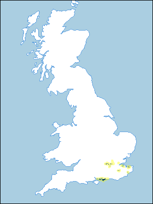
Distribution Map
 |
Note that the yellow shading represents a buffer to highlight the location of very small areas of the association.
Typical Landscapes
Eastern Region
 |
South Eastern Region
 |
South Eastern Region
 |
All information Copyright, Cranfield University © 2025
Citation: To use information from this web resource in your work, please cite this as follows:
Cranfield University 2025. The Soils Guide. Available: www.landis.org.uk. Cranfield University, UK. Last accessed 25/04/2025
